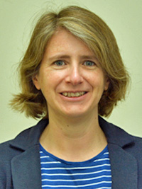
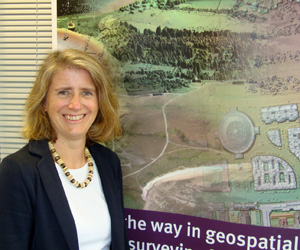
Dr. Alison Matthews is a Geomatics Manager at the Environment Agency, where she leads a team of technical specialists in spatial data capture, processing and analysis. She has a degree in geophysical sciences and a Doctor of Philosophy from the University of Southampton and a Master’s degree in remote sensing applications from the University of Dundee.
“…Over the last 20 years, we’ve mapped about 75% of the country… When we’re finished, the Environment Agency will have completely mapped all 130,000 km2 of the country – the equivalent of 32 million football pitches…”
Combing my love of science and geography through geophysics
I’ve always been a scientist, even since my school days, and for me the most interesting type was applied science. I took geography, physics and maths for my A-levels, which was unusual at the time, but I was always interested in how science can be applied in the real world and geography brought it all together for me.
After school I studied geophysics at university, which introduced me to the concept of remote-sensing – using satellites, aerial photography and laser-mapping to collect information about the landscape from above. I went on to do my Master’s degree in using airborne data to monitor the environment. It was really interesting as, up until that point, I’d been focussed on actually being out and gathering the data on the ground but this enabled me to get a broader picture.
In 1993 I completed my Ph.D., using remote-sensing to investigate coastal water quality, and in 1996 I began working for the Environment Agency’s predecessor, the National Rivers Authority, using this data to come up with a strategy to shape their approach to coastal monitoring. Later that year the NRA became the Environment Agency, and when an opportunity came up to work on delivering this strategy, I jumped at it. I’m now Geomatics Manager – a role I’ve been in for seven years.
The most dramatic thing to change over the years has been the technology – 20 years ago we had to rely on aircraft to collect the data to help us map the landscape. If we were looking to do this in a specific area and a satellite happened to pass over when there was bad weather, the cloud cover would mean we couldn’t get a clear picture of the ground and we’d have to wait until the next time the satellite’s orbit brought it around, which could sometimes be several weeks.
Now, as technology progresses, we are looking to use a variety of techniques including the new generation of satellites and drones.
My role
As Geomatics Manager, I lead a team of about 50 scientific experts responsible for projects that contribute to our mapping and understanding of the natural landscape. The team collects data through aerial photography and laser mapping, develops how we use satellite data for environmental monitoring, and develops our drone capacity.
We advise the Environment Agency in all these aspects of remote survey and also topographic survey. All aspects of the data need to be considered from flight planning, through collection and processing to quality control.
The aerial survey team works at East Midlands Airport, and the topographic survey advisors are located around England so I’m responsible for a dispersed team and need to ensure that everyone feels fully included and valued.
This information on our landscape is used across all of the key strands of the Environment Agency’s work. It helps us survey the condition of our flood defences and plan new ones, and understand our natural resources and habitats. It can even help us detect and fight waste crime. It’s great to see the wide range of uses that our data can be applied to and we are always looking for new opportunities, especially for re-use of existing data.
Mapping the rest of England’s landscape by 2020
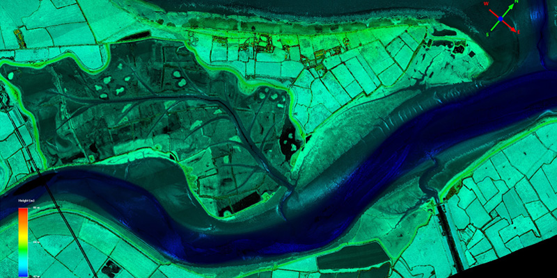
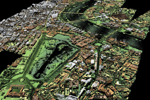
One of the key projects my team does is to survey the landscape with lasers to create 3D maps of the ground and features like hills, rivers and coastline – information which helps inform our work to reduce the risk of flooding and protect the environment.
Over the last 20 years, we’ve mapped about 75% of the country, but we’ve just announced plans to survey all of England, including national parks, Areas of Outstanding Natural Beauty (AONBs) and Sites of Special Scientific Interest (SSSIs) such as the Peak District and the Yorkshire Dales. When we’re finished, the Environment Agency will have completely mapped all 130,000 km2 of the country – the equivalent of 32 million football pitches.
This is an exciting milestone for us, because when we started more than 20 years ago, there was no one else carrying out this work. It was a novel approach, and the Environment Agency has taken it from being effectively a research technique into an actual operational programme completed against budgets and timescales.
The fact that we’ll have mapped the whole country in the next two years is the culmination of that innovative work. It’s an important project because we’ll finally have consistent and high-quality data for the whole country to underpin vital work to protect and improve the environment – work that’s not just being done by us, but by others, too.
We will be able to use the data to look at whole catchments so we can plan and build effective defences to protect communities from flooding. We’ll be able to track changes in the landscape that could indicate illegal waste dumping. And other organisations and charities use it too – for example, Natural England use it to assess wildlife habitat and the Forestry Commission uses it to understand more about the country’s tree cover.
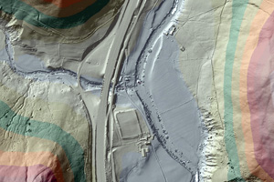
Plus, all the maps will be available to the public for free, meaning anyone can use them for an endless possibility of new projects – the data has already been used by gamers to create 3D videogame landscapes and by archaeologists to shed new light on our ancient history.
It’s all free as part of the Government’s open data programme so it’s even being accessed and used by undergraduates studying environmental science at university, so I’m hopeful that it might inspire even more people to take up a similar career.
Lidar technology
We use small planes equipped with light detection and ranging (Lidar) technology. The laser equipment is contained in a small metal box which is mounted on the bottom of the aircraft and sends a pulse of light out towards the ground to measure the distance between the ground and the aeroplane.
It collects hundreds of millions – sometimes even billions – of point heights, which our team integrates with positioning data (GPS). This produces a cloud of laser points representing the ground surface. These points are checked for accuracy before being converted into a 3D representation of the landscape – called a ‘digital elevation model’ – which can be viewed on a Geographical Information System (GIS) and overlaid with other map layers.
Lidar and drones are just a couple of examples of the high-tech equipment the Environment Agency currently uses, but we’re making the most of other technology too, like using remote-controlled boats to monitor river flows, and sending state-of-the-art incident command vehicles to flooding incidents to help us gather intelligence to inform our response. Plus, our free flood warning system directly alerts more than 1.2 million people if they’re at flood risk, with just the touch of a button.
Gender balance in the Environment Agency
The Environment Agency is a great place for women to work – in fact 42% of our staff is female, and more than a third of our executive managers are women, but we are continually working to recruit and advance more women into science and engineering careers at the Environment Agency.
I’m currently working on an initiative within the Agency to celebrate women in science and encourage them to shout up about their achievements and advances, including a campaign in February to coincide with the International Day of Women in Science. We also reach out to apprentices and new graduates to demonstrate how the Environment Agency is a great career choice for women, and we’re working up materials to present to secondary-school pupils to encourage them to take up a career in science.
 At the Environment Agency, we’re really proud of our diverse workforce – it’s vital to helping us achieve our aims. Different people from a variety of backgrounds will view challenges differently and take unique approaches, helping us get better results from our efforts.
Careers working in the environment
My advice to girls and women interested in environmental or science careers would be to go for it – and start early. Take advantage of the science classes on offer at school, and think about joining an environmental or conservation club.
Be proactive – look for volunteering opportunities to get an edge, keep an eye out for careers that sound interesting to you, speak to different people in the field and maybe even see about getting a mentor. Definitely pursue it – each of us has the opportunity to do something to benefit the environment and make our world a better place to live.
Mapping the future
As we know, technology is changing rapidly. There is so much more available now than when my career began more than 20 years ago. The most exciting development in my line of work will be the wide range of platforms that are going to help us collect mapping data. If we can connect our laser technology to new and more efficient platforms – like unmanned drones, for example – it would be even quicker and easier to collect scientific data.
With more efficient automated systems and higher computing power, we would be able to make swift updates, meaning more up-to-the-minute and accurate information to better inform work like flood defence.
Coming up next
Going forward, I’m working with Defra to look at how we can use remote-sensing technology more widely across the group. Working with a virtual team from the Defra Centre of Excellence for Earth Observation, and also with a cross-government Earth Observation Service, we’ll look at how we can use this information consistently to improve our policy-making decisions. Ultimately this will help us better protect people, wildlife and the environment. We’re going to be busy but it will be worth it!
https://www.gov.uk/government/organisations/environment-agency